A Global Effort to Unleash Local Data: How Open Mapping is Shaping Grassroots Climate Resilience Worldwide
The World Meteorological Organization’s State of the Global Climate 2024 report found that last year was the warmest in the entire 175-year observational record. Rising sea levels, intensifying heatwaves, storms, wildfires and flash floods are no longer occasional disasters but ongoing realities for millions, and they are increasing in scale, frequency and intensity. Meanwhile, the WHO estimates that climate change is expected to cause approximately 250,000 additional deaths per year between 2030 and 2050, with the direct damage to health estimated to cost US $2 – 4 billion per year by 2030.
While this situation is alarming, grassroots solutions are emerging to address it. One community-driven response that’s gaining traction globally is open mapping. Since climate-related crises are inherently geographic, accurate maps are essential to preventing or responding to them. Yet many of the areas where people are most vulnerable to climate impacts lack representation on existing maps, leaving communities and decision-makers without reliable data to address these crises when they strike. Robust, community-generated data that is open, accessible and reliable can be critical in effective climate mitigation and adaptation strategies. Open map data enables communities, governments and organizations to understand risks and develop targeted, data-driven solutions — especially in regions where accurate, localized data is often scarce.
As the climate crisis intensifies, the role of nonprofit organizations in driving open mapping solutions for climate resilience has become increasingly relevant. With their deep connections to local communities and a focus on equity and inclusion, these organizations are uniquely positioned to mobilize grassroots mappers, collect hyperlocal data and translate this data into actionable insights. From tracking deforestation to mapping flood-prone areas, nonprofits are leveraging open data to enable communities and local governments to make informed decisions and build adaptive strategies.
At the heart of this movement is Humanitarian OpenStreetMap Team (HOT), a U.S.-based nonprofit that plays a key role in facilitating collaboration, building tools and enabling communities to support open mapping initiatives. Central to our work is OpenStreetMap (OSM) — a volunteer-driven, crowdsourced platform that empowers people around the world to map their environments and share critical geographic information for the greater good. HOT leverages this platform to support humanitarian mapping, with the goal of aiding disaster relief and preparedness and economic development in vulnerable areas. Our efforts are attracting attention and support from other global development actors, as the sector has a growing interest in ensuring that the most vulnerable communities are not left out of climate solutions.
In 2020, support from the Audacious Project enabled HOT to scale up our work with local mapping communities, with the aim of mapping areas that are home to 1 billion people, including places at high risk of natural disaster or poverty. Over the years, other partners have also come forward to support our work, including Meta, Google.org, Microsoft, the German Federal Foreign Office and other organizations that have fueled our innovative, community-led action initiatives through open map data. This continuous support from partners is helping community-driven solutions like HOT to scale open mapping into a globally accessible, bottom-up resource to support climate resilience efforts, from flood modelling in urban settlements to deforestation tracking in rural regions.
Let’s take a closer look at how communities in emerging economies are using OSM to tackle the challenges of climate change and drive climate adaptation efforts.
Strengthening Urban Flood Resilience in Africa
Located 160 kilometres from Nairobi, Nakuru is the fourth largest city in Kenya and the largest in the Great Rift Valley. A rapidly growing population, unplanned urbanization and unsustainable environmental modification are making Nakuru prone to flash floods, threatening its informal settlements.
In response, Microsoft’s AI for Humanitarian Action and open mapping communities in Kenya and Nigeria came together with HOT to contribute and validate 1.4 million building footprints (i.e., outlines of existing structures on maps) and 19,131 km of road in Nakuru, Turkana and Kisumu, Kenya. These AI-generated and human-verified building footprints, created by the collaborative efforts of community members, students, government workers and volunteers, were layered into dashboards that local planners and disaster response teams now use to develop city plans and prioritize interventions — like reinforcing drainage channels or relocating at-risk populations.
These maps have become tools for decision-making at every level, from local governments to global humanitarian actors, and the datasets are being used by city planners and government leaders to assess flood risk and develop mitigation strategies. By training volunteers from youth and women’s groups in digital mapping and open data tools, open mapping initiatives and organizations ensure that even after a project ends, the community continues updating and using their maps — sustaining resilience beyond any single intervention.
Harnessing Data and Collaboration in the wake of Disaster
Tropical Storm Ana, which made landfall in Malawi on January 24, 2022, caused heavy rainfall and strong winds in several districts. In the aftermath of the storm, Cyclone Gombe also hit the same districts in March 2022, destroying houses, road networks, hydroelectric power stations, schools and health facilities. The devastation from these storms particularly affected the districts of Chikwawa and Nsanje. In response, OSM communities sprang into action, and volunteers came together using mapping as a core strategy to guide both emergency responses and long-term recovery. The primary goal was to develop effective mechanisms for mitigating climate change-related disasters by generating geospatial data critical for disaster recovery, planning and decision-making. To that end, active community participation is essential, as it ensures that the impacted areas are accurately displayed on the map.
In 2022, HOT’s Eastern and Southern Africa Hub supported the Malawi Red Cross Society with a grant through the Open Mapping grant projects, with the goal of providing geospatial insights in the aftermath of Tropical Storm Ana by analyzing critical infrastructure affected in Chikwawa and Nsanje. The data sets were used in decision-making processes crucial for the early recovery of affected communities.
Participatory mapping with satellite imagery and local observations has enabled these communities to understand their own hazards, capacities and vulnerabilities. This project, implemented by the Malawi Red Cross, Nkhoma University and local OSM communities, has provided updated geospatial information on infrastructure and historic flooding damage in the affected districts, establishing baseline data that local stakeholders can use to navigate future flooding events.
Anticipatory Action through Open Mapping
Similar approaches have gained traction in Ecuador, where climate change is intensifying disasters such as floods and landslides, putting vulnerable communities at greater risk. In 2023, HOT worked in coordination with the country’s Risk Management Secretariat to respond to floods in Ecuador’s Las Esmeraldas region. Afterward, this government institution agreed to continue collaborating with our LAC Open Mapping Hub to support the management of the possible impacts of the El Niño climate phenomenon. This collaboration grew into a massive, multisectoral risk mapping project that brought together government agencies, universities, companies and volunteer mappers to generate maps and data aimed at enhancing the response to future flooding in high-risk areas across the country.
Using a hybrid methodology developed collaboratively with YouthMappers from Ecuador’s University of the Armed Forces, the initiative prioritized vulnerable areas based on factors like rainfall, slope and proximity to rivers. Then it built a replicable model for anticipatory action through community-driven mapping, as its volunteers used OpenStreetMap to create vital geospatial data that had been previously unavailable. This collaborative effort provided crucial baseline information for disaster preparedness, and helped local authorities and humanitarian actors better understand exposure and risk in disaster-prone areas.
What makes this initiative stand out is its emphasis on building local capacity. Through “mapathons,” training sessions and strategic partnerships, it trained Ecuadorian youth, students and other community members to lead data collection efforts and use digital tools for climate resilience. By combining global support with local knowledge, the project not only generated high-quality open data, but also fostered a culture of community-driven preparedness.
These detailed maps and community-led data are now feeding into national disaster plans, helping governments and NGOs prepare smarter and respond faster. This is a prime example of how the power of collaboration — and the use of quality data from open mapping tools and collaborative databases like OpenStreetMap — can be a cornerstone of climate adaptation and resilience in the face of growing environmental risks.
From Maps to Dashboards: How Open Data Drives Action
Maps are powerful, but maps alone aren’t enough — they must be actionable to drive real-world impact. To facilitate this impact, mapping organizations are transforming raw geographic data into decision-support tools like interactive dashboards. These tools integrate open mapping data with other critical sources of information — such as satellite imagery, weather forecasts, flood vulnerability indices and infrastructure data — to provide a comprehensive resource for decision-makers to use during environmental and humanitarian crises.
For example, in Nakuru, Kenya, local authorities are using dashboards that visualize rainfall forecasts overlaid with mapped flood-prone zones and drainage systems. This helps authorities to take anticipatory measures and issue warnings to communities at risk in anticipation of heavy rains, reducing the likelihood of disaster and protecting lives.
Humanitarian OpenStreetMap Team has collaborated with community mapping groups and government agencies in countries like Uganda, Indonesia and Madagascar to train local actors to use tools like KoboToolbox, QGIS and Mapbox, which allow communities to visualize risks like landslides, drought-prone areas or proximity to health services — all vital for climate adaptation planning.
Tackling climate challenges requires more than awareness — it requires accurate and accessible data that allows communities to prepare, adapt and respond faster. Open map data is transforming how the world anticipates, responds to and recovers from climate-related disasters, enabling co-created solutions that are both accessible and collaborative. By helping communities build local capacities and facilitate localized action, these solutions are proving that resilience doesn’t always require high-end tools: It can start with a smartphone, a satellite image and a commitment to mapping what matters. Because when communities can see themselves on the map, they can start to shape their own future — one that’s more prepared, more just and more resilient.
Atiya Anis is Senior Communications Advisor at Humanitarian OpenStreetMap Team. The views expressed in this article are based on the writer’s insights, supported by resources available online.
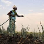
Photo credit: Humanitarian OpenStreetMap Team
- Categories
- Environment, Technology
- Tags
- climate change, data, NGOs


